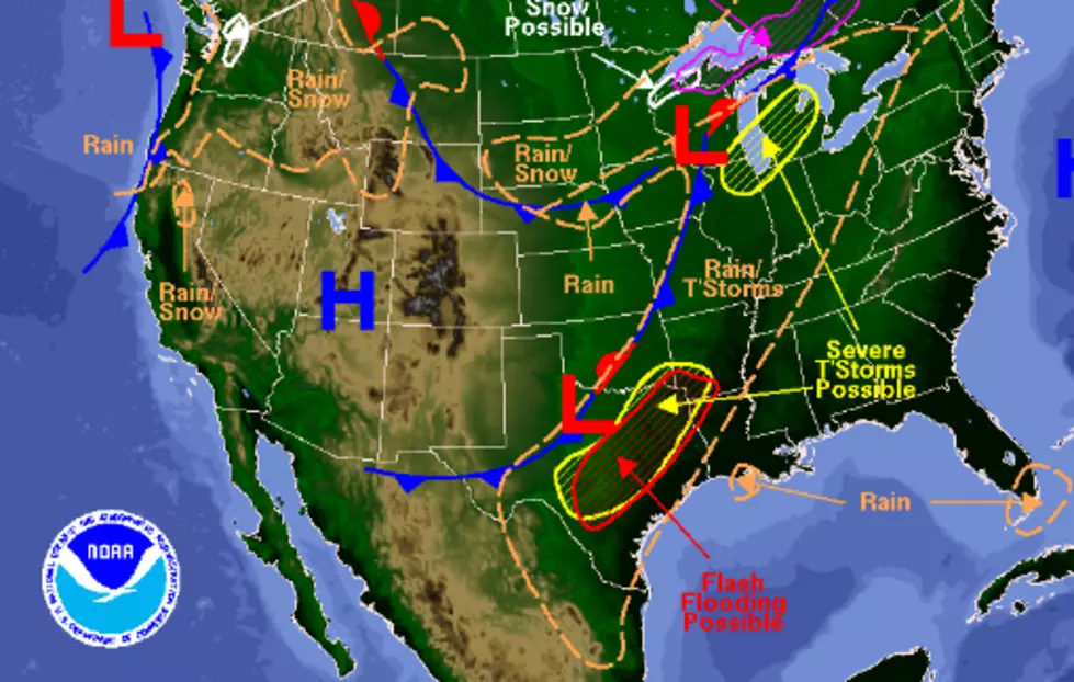

A Chance For Thunderstorms Friday And Sunday In Killeen, Temple
The National Weather Service is calling for Showers and Thunderstorms to move into central Texas overnight with the chance for thunderstorms by daybreak Friday.
If storms develop we can expect a chance for heavy rain, gusty winds, and frequent cloud-to-ground lightning possible early Friday morning. Allow extra time for your trip to work if the system does kick up, and remember never to try and cross flooded roadways.
These storms will move east of I-35 by early Friday afternoon and that is the location of some unstable air that will help to strengthen these storms. Areas East of I-35 in the path of these storms should expect strong winds and could also see large hail.
The next chance for strong thunderstorms arrives Sunday afternoon into Sunday night. Strong straight-line winds and hail will be the biggest threat with Sunday's storms.
Stay weather aware Friday morning with our partners in the KWTX Doppler Ten Forecast Center! You'll find live weather radar here.
More From KUSJ-FM